
Start a Victoria Street Search
A street search can connect a parcel to public ownership records, a recorded transfer trail, and older address sources. It cannot establish every current occupant. A Victoria street directory search begins with Victoria Central Appraisal District, usually called CAD, because it supplies the useful first parcel record. Its card can distinguish the physical location from the tax mailing address. The parcel map then helps place that result on the right stretch of street before names from a deed or a historical directory are compared.
Use this order when the known fact is a Victoria address. It moves from a current address record toward dated ownership and household evidence, without treating one record as proof of everything.
- Enter the house number and street name in Victoria CAD eSearch, then keep the returned geographic ID and legal description with the situs and mailing fields.
- Open the CAD GIS route, find the parcel on the street, and visually confirm its location before relying on a map result.
- Use the current owner and legal description to locate the present deed in the County Clerk index, then read the seller and recording details.
- For voter evidence, contact Victoria County Elections about a roster or a defined-area voter-file request. There is no verified public form that returns every registered voter on a street.
- For earlier household clues, check the address section of local directories and compare the next available volume or census release.
That address to CAD, GIS, deed, voter-file, and criss-cross workflow is deliberate. Each stop answers a narrower question than the last.
Victoria CAD Address Fields
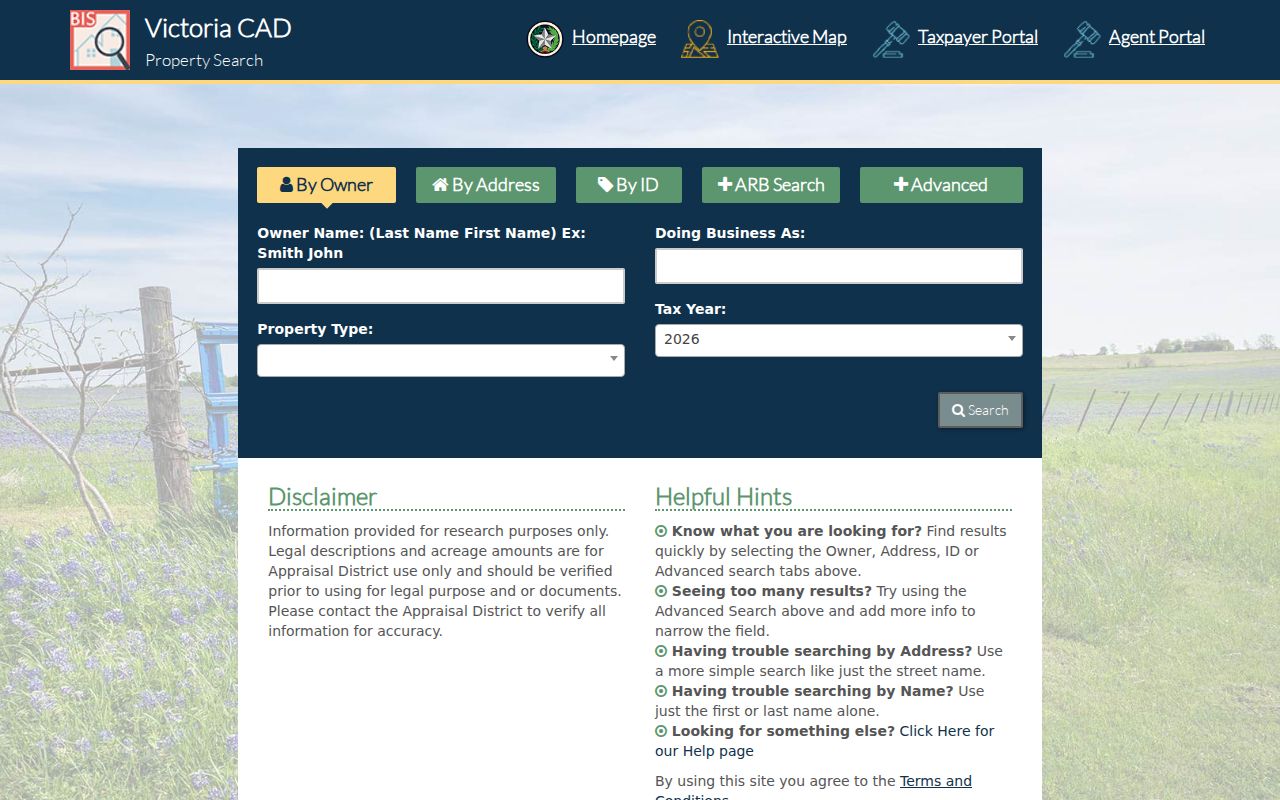
The CAD property portal accepts several ways into the same parcel record. For a street-wide pass, the Street Name instruction is unusually important: omit prefixes, suffixes, and unit numbers. A simple name can return a broad set to review, after which Street Number, Tax Year, Subdivision, Neighborhood, or Property Type can narrow the result. Owner Name is a separate route when an address is incomplete. The visible portal did not state coverage years or the choices within its select fields.
| CAD field | Input type | Required | Observed use or format |
|---|---|---|---|
| Owner Name | Text | Not marked | Last Name First Name |
| Street Number | Text | Not marked | Optional address number |
| Street Name | Text | Not marked | No prefix, suffix, or unit numbers |
| Property ID / Geographic ID | Text | Not marked | Parcel identifiers |
| Tax Year / Property Type | Select | Not marked | Options were not exposed |
| Subdivision / Neighborhood | Autocomplete text | Not marked | Separate search controls |
The Victoria CAD search screen is shown in the official source image below. It is a good reminder to record the search wording used, especially when a directional version or an old abbreviation may be involved.
After a result appears, use acreage and legal-description details as checks on the parcel rather than as a substitute for the underlying official record. This Victoria street directory step preserves the exact input that produced the parcel.
Victoria Parcels on GIS
GIS provides the visual bridge between an address result and its surrounding parcels. Victoria CAD links to its interactive map, while the City of Victoria provides an interactive maps route. Locate the street segment, select the parcel where the viewer allows it, and copy the geographic ID back into CAD. That sequence is safer than assuming that a nearby polygon has the same address.
The city warns that map information may not be accurate, timely, or complete. The inspected research did not verify the map's exact layer names, click controls, or parcel-popup fields. Treat the visual result as a way to orient the address, then verify it against CAD and a recorded instrument.
- Parcel
- A defined piece of property shown in an appraisal or map system, often tied to a geographic or property ID.
- Situs address
- The physical location of the parcel. It is different from a mailing address used for tax correspondence.
- Plat
- A recorded map that can show a subdivision, lots, blocks, and street layout.
- Criss-cross directory
- The address or street section of a directory, used to look from a number toward an occupant listing.
For a run along one Victoria street, keep each parcel's legal description beside the current street number. Street numbers can change or be written differently; the legal description is the more durable handoff to deed research.
Victoria Deeds by Address
Move from the CAD owner and legal description to the County Clerk's grantor-grantee index. Find the deed that conveyed the parcel to the current owner, note the seller, buyer, recording date, document or book reference, and legal description, then search the seller as a grantee in an earlier transaction. This does not prove that every owner lived at the address. It creates the legal transfer sequence tied to the parcel.
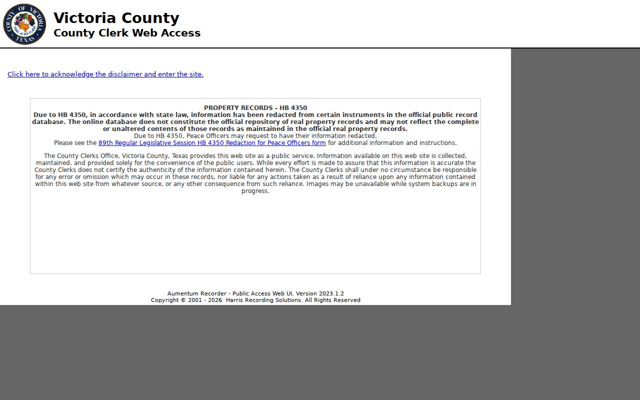
The Victoria County Clerk public-record portal requires a disclaimer acknowledgment. It says the web copy is not the official repository, may be incomplete or changed from an unaltered record, may contain redactions, and can have images unavailable during backups. Its online index and imaging cutoff has not been located in official sources. When the web result stops, ask the County Clerk counter which deed books or copies cover the needed period, rather than assigning the portal a date it does not publish.
The County Clerk portal source image captures that important limitation. A present-day online result is a starting point, not a statement of complete Victoria deed coverage.
Recorded instruments can also be redacted, and the County's recording notification service watches only future matching grantor or grantee names. It is an alert service, not a title search.
Victoria Address Record Coverage
Street-by-street work becomes clearer when each record is used for the evidence it actually carries. The table separates current parcel facts, legal transfers, dated city activity, and historical household clues. It also shows why a blank result in one source should lead to another access channel instead of a conclusion that no record exists.
| Address source | Key used | Evidence returned | Victoria access path |
|---|---|---|---|
| CAD eSearch | Owner, street, parcel ID, tax year | Owner, situs and mailing fields, parcel facts | Online public search |
| CAD GIS | Parcel polygon or street | Map context, adjacent parcels, geographic ID | Online map, then verify |
| County deed index | Grantor, grantee, legal description | Legal ownership and transfer trail | Disclaimer-gated web, counter, or copy request |
| Voter roster or file | Defined area request | Public voter-file fields, subject to protections | Elections office and written request form |
| City permits and code | Street address or block | Dated work or complaint-condition trail | Monthly reports, city route, or request |
| Directories and census | Street and address | Historical household clues | Victoria library, UHV, and archives |
The record chain is a comparison, not a merge. A tax mailing address, a deed party address, and a directory entry can each refer to a different relationship with the same parcel. A careful street directory keeps those relationships separate.
Victoria Voter File Limits
Victoria County Elections offers county resources, roster links, and a written voter-file request route. A requester can define an area by precincts, city, school district, county commissioner precinct, or all county. The form requires an affidavit and restricts commercial promotion or advertising use. It does not create a verified public button for every voter on a named street.
Texas Election Code public fields include name, date of birth, voter-ID number, and elections voted, not how someone voted. Protected voters and confidential residential addresses are handled separately. Rosters can be election-specific, so they should not be read as a current list of every household member. Contact the Victoria County Elections office to confirm the available roster, area, format, and protected-field limits for a request.
Note: A voter-file result is public-record evidence with statutory limits, not a complete occupancy record for an address.
Victoria Permit and Code Layer
City permit reports add dates to an address trail. The reported fields can include permit type, work class, permit number, project, address, valuation, square feet, owner, contractor, and amount paid. They can show that work was reported at a property, but they do not establish a complete household history. The city links development services and the MGO permit route, although the research did not verify live MGO public fields.
Code Enforcement accepts an address or a block for a complaint. Complaint information is confidential, so a code record is not a resident directory. Use the City Code Enforcement route for current reporting information or the city's public-information channels when a public record may exist. A dated permit or code event can help place an address in time without identifying a resident.
Victoria Street Name Quirk
Victoria's City and County Street Index is a useful spelling check before declaring an address search unsuccessful. The street index lists directional E, W, N, and S forms along with street-name variants. CAD's Street Name box, by contrast, instructs the searcher to omit prefixes and suffixes. Those two facts are compatible: use the index to recognize a directional form, then follow the portal's simpler input rule.
The original Victoria town was laid out as a one-mile grid around a central plaza. Later annexations expanded beyond that early grid. No official source located a dated citywide street-renaming or renumbering event, so an older number should be bridged with the street section, parcel, plat, and legal description rather than presumed identical to a current address.
Victoria Street History Clues
For an earlier Victoria address, use a reverse or criss-cross section rather than relying only on alphabetical name entries. UHV describes its directories as attempts to include resident and business names, not as simple telephone books. The local directory sequence is uneven: 1900-1901, 1913, 1927, 1939-1956, and Polk volumes from 1957 to current reference holdings. A missing year is a collection gap, not proof that an address was vacant. The street directory remains an address-led comparison, not a complete household list.
Victoria Public Library's local-history resources and UHV's Regional History Center supply the most useful fallbacks. UHV access is by appointment and some materials may need advance retrieval. The Victoria City Directory route identifies the collection locations and entry-reading details. Pair a directory address with the federal census when a public census year is available, then use deed, newspaper, permit, or probate material to check the time between volumes.
Federal census records are public through 1950 under the 72-year rule; 1960 is not due for release until 2032. The 1890 census was mostly destroyed, so an address trail may need directories, newspapers, deeds, church records, or tax and permit material to bridge that period.
Victoria Street Privacy Limits
A parcel is not a household roster. Renters, other household members, protected voters, utility customers, delivery addresses, and confidential complainants may be absent from address-linked sources. Driver-license information is restricted under the federal Driver's Privacy Protection Act, and Texas law protects several categories of personal and library-use information. Do not fill those gaps by making assumptions from a map, a mailing address, or a same-name result.
For a record unavailable online, the documented fallback sequence is the custodian's counter, a copy request, a written Texas Public Information Act request for nonexempt county or city material, or library and archive reference. A written request may be mailed, e-mailed, hand-delivered, or sent through an authorized route; the office can ask for clarification and may assess allowed charges. That route addresses an access gap without claiming a protected record is public.